
The Red Centre Way is an epic road trip, taking you through the best of Central Australia. There’s no better way to explore the vast Northern Territory outback than driving this route, stopping at as many of the lookouts, gorges, waterholes and landmarks as you can.
We spent almost two weeks exploring the Red Centre Way and Central Australia and had the absolute best time. This part of Australia is unlike any other. You can drive for hours and not see another car. You can have the most beautiful waterhole all to yourself. You can stand in the middle of the road and see nothing but red dirt in every direction. It’s absolutely amazing and a place every Aussie should try to visit at some point in their lives.
There are a few things to know before you start your Red Centre Way road trip though, so we’ve tried to put together all the information you might need to know before you take off on your trip. Here’s our ultimate guide to driving the Red Centre Way.

In this post:
Where to find fuel
First things first, if you’re going to drive the Red Centre Way you need to make sure that you have enough fuel, and know where the next fuel stops are so that you don’t run into trouble. There are huge remote distances between petrol stations, with limited phone reception most of the time and few cars passing by, so the last thing you want to do is run out of fuel.
The fuel stops along the Red Centre Way can be found at:
- Glen Helen Lodge
- Hermannsburg Historic Precinct (although when we visited the fuel “wasn’t working”, so I’m not sure what that means)
- Kings Canyon Resort – this is the best fuel stop along the way
- Kings Creek Station
- Curtain Springs Inn
- Yulara
And along the main road that connects Yulara and Alice Springs you can also find fuel at Erldunda Desert Oak Resort and Stuarts Well.
Expect high prices for petrol and diesel at all of these stops. These places are incredibly remote, so you can’t expect the prices that you would normally find in the city. The most expensive fuel we found was at King Canyon Resort which was $1.95 a litre for diesel, although depending on when you travel there are regular reports of diesel exceeding $2.20 per litre.

Where to stop along the Red Centre Way
There are so many different places to stop along the Red Centre Way, with campgrounds at many of the gorges and some great free camps to be found all along the way. Here is a bit about the route that we took and some of our favourite places to stop along the way.
Alice Springs to Neil Hargrave Lookout
Distance: 107 kilometres, 1 hour 10 minutes
The first part of our road trip was the shortest, but that’s just because there are so many places to stop along the way here. The West MacDonnell Ranges are full of some amazing landscapes, and is definitely worth taking the time to explore. This short stretch has almost half of the stops in the West Macs, so give yourself the time to check out as many as you can.
What to see along the way:
Simpsons Gap: The first stop along the way and one of the most prominent gaps in the MacDonnell Ranges. There’s a little waterhole in the middle of the gap, although swimming isn’t allowed at this spot. Plus it’s only 20 minutes from Alice Springs.
Standley Gorge: The only privately owned attraction in the West MacDonnel Ranges, it costs a small admission fee to visit Standley Gorge but it’s definitely worth it. Stand in the middle of the Chasm with the tall walls reaching high into the sky. The walls change colours throughout the day, with vibrant red and orange colours, depending on the time of day you visit. Around midday is thought to be the best time to visit, when the sun is right above the chasm lighting up both sides.
Ellery Creek Big Hole: A favourite spot to everyone along this track, visit the Ellery Creek Big Hole in the early afternoon for the best views. This is one of the permanent waterholes in the West MacDonnell Ranges, even if it is freezing cold all year round, and you are able to go swimming here if you can brave the cold. A great spot to camp for the night as well.
Serpentine Gorge: The only gorge we missed out on along the way, Serpentine Gorge is the next stop along the Red Centre Way. There is a short hike with beautiful views over the ranges and the outback, as well as a small waterhole to visit on the way.

Neil Hargrave Lookout is a great free camp, and one of the few places along the Red Centre way that have Telstra phone reception. It’s free to stay here for 24 hours and is only a short drive away from some of the best sights in the West MacDonnell Ranges. There are bins available as well as fire pits, but that’s all so you need to be self-contained if you’re going to camp here for the night.
We parked our van at the camp spot right next to the satellite dish and were able to have full reception in our van with our celfi-go boosting the signal. There were no issues making phone calls, using the internet and social media for the whole night. Without the boost we were able to get adequate reception standing right next to the dish. Perfect spot if you need some reception during your trip.

Neil Hargrave Lookout to the Mereenie Loop
Distance: 96 kilometres, 1 hour
The next part of the drive is home to our two favourite places in the West MacDonnell Ranges, Ormiston Gorge and Redbank Gorge. At the end of Larapinta Drive there is a fork in the road. You can either turn left towards Hermannsburg, which continues you on a sealed road to Palm Valley and then on towards Alice Springs, or you can turn right which leads you towards the unsealed Mereenie Loop road.
What to see along the way:
We woke up early in the morning the next day, ready to check out some more of the gorges and hidden secrets of the West MacDonnell Ranges, and when we thought it couldn’t get any better we found two of our favourites the second day.
Ochre Pits: The local Aboriginal people still use this spot to mine ochre that they use in their traditional ceremonies and decorations. Visit the pits to see the rainbow coloured walls, streaked with red, orange, yellow and white ochre.

Ormiston Gorge: One of our favourites, this is a great gorge for everyone to visit. There is a paved pathway that takes you down to the waterhole, that is surrounded by a sandy bank and is the perfect place to spend an afternoon. The water here is ice cold, but you are able to go for a swim if you dare! Take the time to walk up to the Ghost Gum Lookout for amazing views over the water hole and the whole gorge.
Glen Helen Gorge: One of the only spots in the West MacDonnell Ranges that has a fuel stop. Walk through the tall river reeds to get some great views over the gap in the ranges here. There are many dreamtime stories that originate from Glen Helen Gorge, including the one about the well-known Rainbow Serpent.
Redbank Gorge: The most difficult gorge to get to, but by far the most beautiful. This gorge is absolutely stunning, with tall rugged red cliffs towering over the small waterhole. It’s about 1.5 kilometres to get to the actual gorge and you need to clamber over a rocky pathway to get here, but the views at the end are absolutely worth it.
Originally we had planned to spend the night at Hermannsburg – also known as Ntaria to the locals, so that we could visit the Palm Valley. However, when we arrived we found that they had no fuel (or that it “wasn’t working”, we’re not really sure what was going on) and that the campground was chained up and not accepting visitors. So unfortunately we decided to keep moving. We didn’t want to take our van to Palm Valley, as the roads are meant to be pretty bad, and we needed fuel if we were going to make it all the way to Kings Canyon. So we continued on along the Mereenie Loop.

The Mereenie Loop
Distance: 154 kilometres, 1 hour 43 minutes
The Mereenie Loop is an unsealed dirt road that continues the Red Centre Way out towards Kings Canyon. It takes you along the road less travelled, through some really beautiful landscapes in the Central Australian Outback. We only passed one other car on the road out here, and loved every minute of this route. We were very excited to see a handful of wild camels along the way, just hanging out on the side of the road at around sunset, as well as a family of dingoes. Nothing better than seeing animals in the wild of the Australian Outback!
When we were still in Alice Springs a fellow traveller told us that the Mereenie Loop was the most difficult dirt road we would encounter across Australia with our caravan, so I was a little bit nervous before we started. But it was actually absolutely fine. Once we let the pressures down it was actually quite a smooth drive, the corregations weren’t that bad at all, and much of the road was actually a pretty smooth drive. There are a few dips along the way that shook things up a little bit, but overall the caravan was an absolute champ and did a great job through the outback!
If you’re planning on travelling the Mereenie Loop (especially with a caravan) our top tips are:
- Let the pressures down on your tyres before you start, makes a huge difference
- Watch out for dips in the road and drive a little slower over them as some of them can be quite deep
- Make sure you know where your next fuel stop is, as we only saw a small handful of cars along the way
We spent the night at the Morris Point Lookout (also known as Ginty’s), a free camp along the Red Centre Way. There was no reception here, with a few bins and epic views over the outback. Another spot where you need to be self-contained, as there are no toilets or anything here. The lookout is about 29 kilometres to Kings Canyon and the resort, so it was a great place to stay to save us an extra night of paid accommodation. You can stay here for up to 24 hours for free.

Kings Canyon
The epic Kings Canyon is a top highlight for anyone driving along the Red Centre Way. Found in the Watarrka National Park, the canyon was formed millions of years ago and following one of their walking trails will offer you some jaw dropping views over many different types of landscapes. From the vast depths of the canyon, to a mini tropical oasis in the middle of the walk, there is something different around every turn.
Spend the time to walk the Kings Canyon Rim Walk for the best views over the canyon. The 6 kilometre walk takes 3-4 hours to complete, starting with a steep 500 step incline that can be quite difficult, especially on a hot day. In fact, the rim walk closes at 9am on days which are forecast to be hotter than 35°C for safety reasons.
There are also a number of shorter walks you can try in the Rim Walk seems a bit much for you. We’d recommend the South Wall Return Walk, which will still give you those amazing views over the canyon, but is only 4 kilometres return and doesn’t have the harsh incline of the Rim Walk.
We spent the night in the Kings Canyon Resort campground, which is the closest accommodation to the Canyon. It’s an expensive stay but understandable given it’s such a remote location. Make sure to check out a sunset from the viewing area close to the campground, the canyon glows red at sunset and is absolutely beautiful. There is no Telstra reception at Kings Canyon, although there is apparently limited Optus reception. Avoid paying for wifi at the resort by taking advantage of the free wifi at the Kings Canyon car park, what an absolute gift that is.
Kings Canyon Resort || Luritja Road, Watarrka National Park || Ph: 1800 837 168

Kings Canyon to Yulara
Distance: 305 kilometres, 3 hours 11 minutes
The drive from Kings Canyon to Yulara is all on sealed roads and is very easy, although sometimes quite boring. There’s only a handful of stops and things to see along the way, with most of the drive just being through the vast outback. It’s a good idea to fill up in Kings Canyon before you leave.
The between Kings Canyon and Yulara you will find:
Kings Creek Station: a working cattle and camel station that also offers camping, accommodation, helicopter tours, camel rides and quad bike riding. There is also a fuel stop here at the station, as well as a small shop that offers basic supplies, meals and drinks. The station was still closed due to Covid-19 when we passed through Red Centre Way, so unfortunately we didn’t get to check them out this time.
Mt Connor: often easily mistaken as Uluru by first time visitors, Mt Connor can be seen in the distance from the highway and is a huge looming rock in the distance. It’s a very sacred site for Aboriginal men, known in the local language as Atila. There’s a rest stop lookout here to stop and take a photo on your way through.
Curtain Springs: the only roadhouse between Kings Canyon and Yulara, Curtain Springs is a great place to stop and stretch your legs. There is a small shop here, a petrol station and they also have a menu of hot food if you’re looking for something to eat. Even better, if you’re looking for somewhere to stay they offer unpowered campsites for free, with powered sites for only $3 per night.

Uluru
The spiritual heart of Australia is a place that needs to be on everyone’s bucket list. It is a place that needs to be felt to be seen, needs to be experienced to be understood. There is just something so magical about Uluru and there are so many different experiences to be had there during your visit. This was our second visit to Uluru and it was just as memorable and amazing as the first. It’s a place that will keep us coming back again and again.
Here are some of our posts from Uluru to help you plan your visit:
- Where To Stay At Uluru: Ayers Rock Resort
- A Magical Night At The Field of Light
- The Best Can’t Miss Things To Do At Uluru
- Flying Over The Outback With Ayers Rock Scenic Flights

Yulara to Alice Springs
Distance: 447 kilometres, 4 hours 40 minutes
It’s an easy drive from Yulara back to Alice Springs along the Lasseter Highway and then onto the Stuart Highway. It’s a completely sealed highway road all the way and is a much faster way of getting back to Alice! There are a few different roadhouses and places to stop along the way:
- The first two are Curtain Springs and Mt Connor that we mentioned earlier, which takes you back to the Red Centre Way turn off.
- The next is Erldunda Roadhouse at the corner where you turn onto the Stuart Highway. Make sure you check out their emus out the back, they love to come right up to the fence to say hello and you can also buy some food at the roadhouse if you’d like to feed them.
- And finally there’s Stuarts Well Roadhouse which is right next to a camel farm. If you haven’t seen any camels on your trip around the Red Centre Way, here’s a great place to stop and see one.

YOU’VE DONE IT!
That completes the epic Red Centre Way road trip!! After all that adventuring there is a much faster way to get back to Alice Springs, along the Lasseter Highway and then onto the Stuart Highway. It’s an amazing road trip and is definitely worth taking the time to explore all the different spots along the way.
Explore more our adventures around the Northern Territory
Pin for later >>


Happy travels,
 If you enjoyed this post, we'd love you to SHARE it for us!
Follow us on Instagram @EXPLORESHAW to see our latest adventures around Australia.
CHECK OUT OUR TRAVEL FAVOURITES:
If you enjoyed this post, we'd love you to SHARE it for us!
Follow us on Instagram @EXPLORESHAW to see our latest adventures around Australia.
CHECK OUT OUR TRAVEL FAVOURITES:
![Fujifilm X-T3 Mirrorless Camera]()
![Ultimate Weekends Australia]()
![La Tan Coconut Sunscreen]()
![Nikon Z fc Mirrorless Camera]()
![DJI Mavic 2 Pro Drone]()
![Frank Green Insulated Drink Bottle]()
![Manfrotto Tripod]()
![Lonely Planet Australia Travel Guide]()
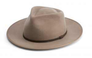
![Will & Bear – Calloway Fawn Hat]()
![Sony RX100 VI Camera]()
![Bushmans with Sunscreen]()
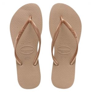
![Havianas Slim Thongs in Rose Gold]()
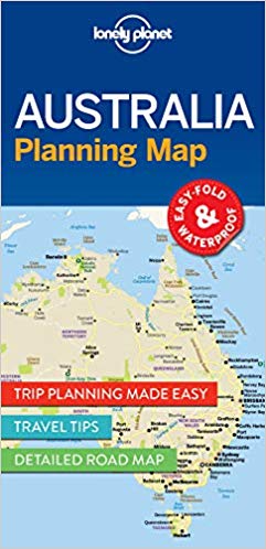
![Australia Planning Map]()
![Casetify Tropical Palm Neon Sands iPhone Case]() CLICK HERE TO SUBSCRIBE to our newsletter, for blog posts and updates emailed straight to your inbox!
Use THIS LINK for $25 AUD off your next hotel stay with booking.com, or THIS LINK for $55 AUD off your first booking with airbnb.
CLICK HERE TO SUBSCRIBE to our newsletter, for blog posts and updates emailed straight to your inbox!
Use THIS LINK for $25 AUD off your next hotel stay with booking.com, or THIS LINK for $55 AUD off your first booking with airbnb.


No Comments